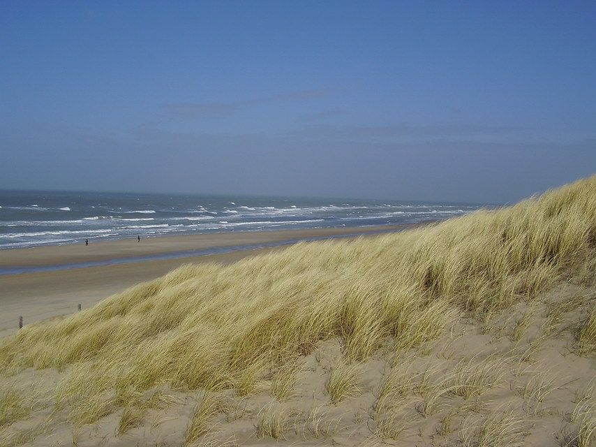
Sandy shores appear as beaches in enclosed bays between rocky headlands or as long stretches of sand adjacent to coastal dune systems or sandy spits. Sandy shores are highly dynamic environments, have a characteristic biodiversity and represent a unique gradient of habitats. The environment is attractive for housing, accommodates key marine infrastructure and provides excellent opportunities for fisheries, recreation and drinking water resources, thus represents high economic value. Natural development of sandy shores depends on the accumulation of sand that is transported to the coast from inland sources by rivers, and / or from marine sources by waves, currents and wind. The morphology of a sandy shore supports the habitats and ecological processes in this environment. On the long term, sandy shore development is governed by the balance between the net supply of sediments and the demand, created by sea level rise and subsidence.
Since ancient times, sandy shores have attracted human activity. They provide in goods and services, such as constituting a natural coastal defence, providing fresh water and sustaining economical activities such as fisheries and recreation. Sandy shores around the world are now being affected by high population densities, subsidence and sea level rise. Keeping them in good shape is therefore an increasingly important issue in coastal management, aiming at maintaining their unique natural and socio-economic values.
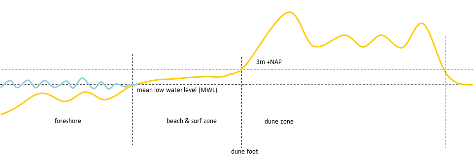
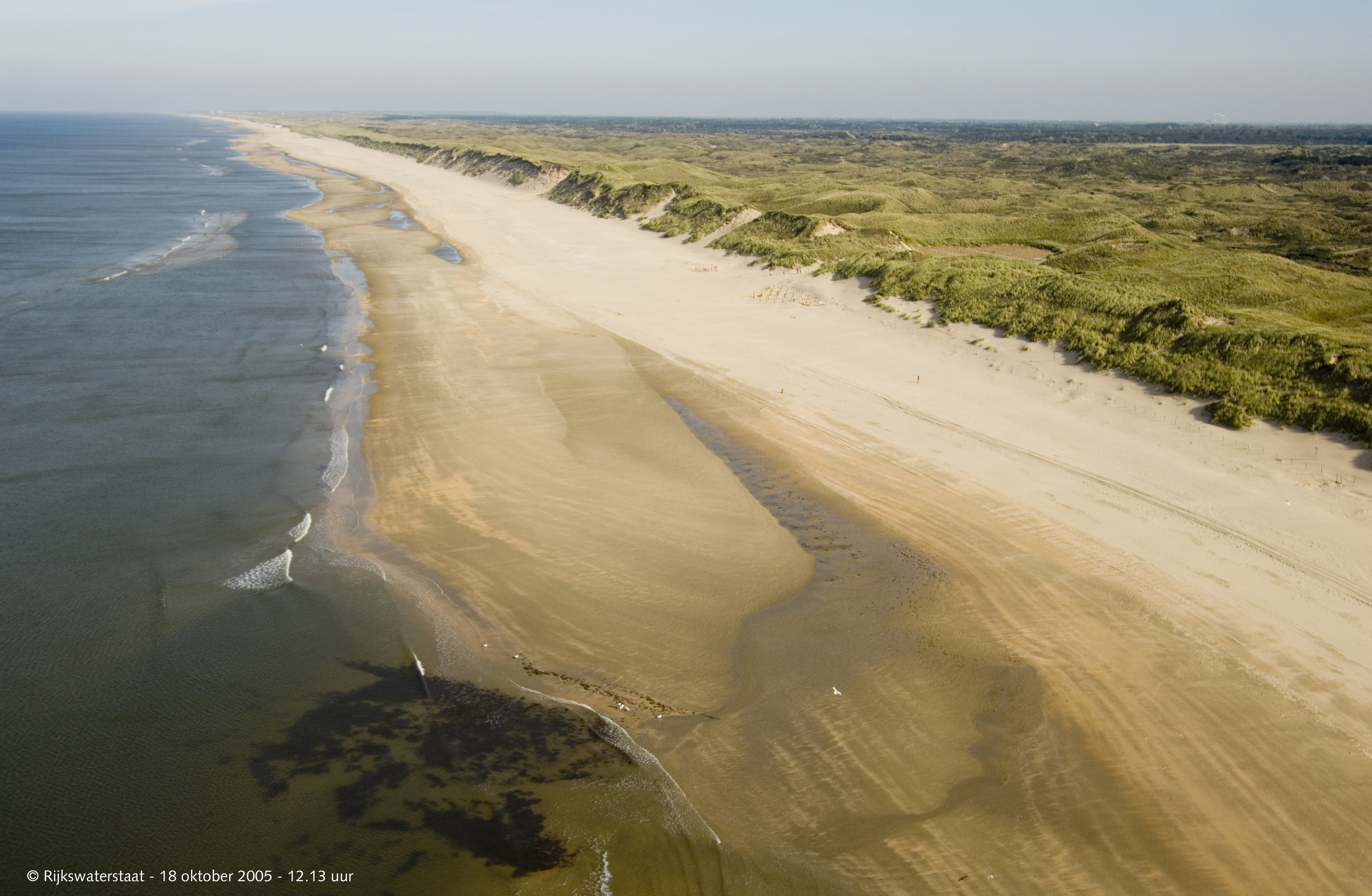
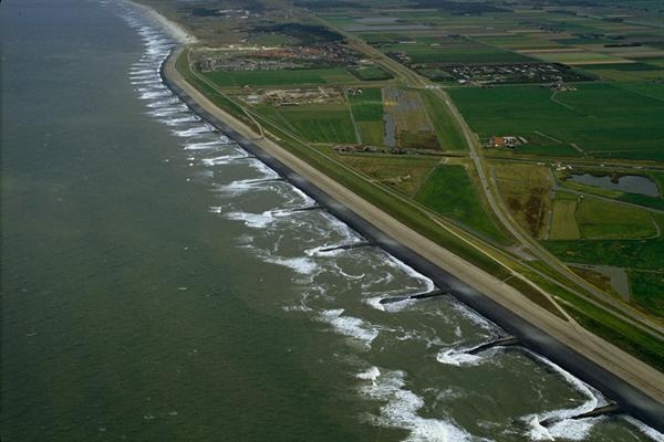
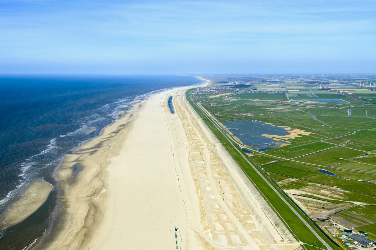
A sandy shore is characterized by a sandy profile from the point where wave action reaches the sediment bed, through a wave-dominated subaqueous zone and a wind and wave dominated beach, up to the dune belt where aeolian processes dominate. This is also known as the active zone, which differs per location and depends on the time frame considered. The area seaward of this active zone, up to a depth of approximately 200 meters, is known as the coastal sea (or shelf sea). The present chapter focuses on sandy shores in temperate climate zones. Information on sandy shores in tropical zones is found under Tropical shelf seas and shores.
Sandy shores constitute dynamic environments and unstable substrates, exposing plants and animals to varying and potentially harsh conditions. Moving sands, salt spray, nutrient-poor soils and rapidly changing conditions make it a difficult habitat to live in. The shore dynamics, driven by tides, waves and wind greatly influence the occurrence of species (Janssen & Mulder, 2004). This yields a characteristic biodiversity and unique habitat gradients. A wide variety of organisms inhabit sandy shores, some terrestrial (on the beach and in the dune area), others living under water, and some found primarily in the intertidal zone between land and water. Beach organisms are often small and buried (e.g. crabs, worms, sand hoppers, shellfish, insects and beetles). A wide variety of birds feed around the waterline.
Due to the usually high nutrient concentrations, coastal waters and sandy shores have a high primary production and are therefore important as breeding grounds, resting areas and nurseries for a variety animal species. They also provide multiple benefits to society such as recreational opportunities, groundwater reserves for drinking water and coastal protection. Further information on human benefits derived from sandy shores are discussed in the section Ecosystem services.
So far, the Building with Nature programme has focused on meso-tidal, wave-dominated coasts. Knowledge and expertise gained here may be of use to coasts with similar characteristics and maintained by nourishments, or to parties considering the implementation of a nourishment strategy to maintain their coast.
System description
Biodiversity is high on sandy shores, with all major taxonomic groups represented. In general, species diversity varies across the coastal profile. On the beach, diversity increases from the high water to the low water line, then decreases again lower in the surf zone, to pick up strongly – in mass as well as diversity – further seaward (Brown & McLachlan 1990). On a local geomorphological scale differences can even be found between the troughs and crests of mearshore sand bars. As dunes, beaches and foreshore are important habitats for a variety of species, international legislation is put into place to safeguard their protection. As shorelines around the world are under pressure from human activities, their nature value needs defending while maintaining their socio-economic value.
Physical processes on sandy shores are highly variable, both in time and in space and at a wide range of scales (from individual particle movement to global, sea level rise). Organisms living here are adapted to this dynamic environment and reflect the complex ecomorphological interactions. Human interventions will change the environment and may generate anomalous habitat conditions. Whereas an intervention (for example a shore nourishment) at a certain location may cover only a few hundred metres and take not more than a few weeks or months, the effects may extend over several kilometres along the coast and may last for years. When designing an intervention, it is therefore essential to consider the biophysical interactions involved and the different scales at which they take place. Building with Nature takes these processes into account and tries to make use of them wherever possible. In the following sections, the principal processes will be discussed, distinguishing smaller and larger scale processes.
Physical drivers
All ecosystems, from subtidal zones to dunes, are dynamic environments and abiotic conditions change frequently and continuously. High-energy agents, such as wind, waves, and tides, drive sediment from or to the coast, thereby continuously influencing the different ecosystems. All drivers show a strong variability, both in time and in space.
Tides vary daily; wind and waves may change from one hour to another, but also one season to another, and even at interannual and decadal scales. Tides, wind and waves are the dominant drivers on a time scale up to years. Over longer periods, other (more slowly reacting) drivers, such as sea level rise, subsidence and groundwater flow, gain a more prominent role.
All drivers vary spatially as well. An example on a small to medium scale, is the occurrence of rip currents, concentrated seaward flows starting from the beach and fed by shore-parallel currents from either side. On a large scale there is, for instance, the regional variation in subsidence. In the following, the short- to medium-term physical drivers are characterized; the long-term drivers will be described separately.
Wind, Waves and Tides (short- to medium-term drivers)
The main drivers that influence sandy shores on the short to medium term (days to years) are the wind, waves and the tides. When the wind direction is between onshore and alongshore, windblown sand gradually migrates landward away from the water. Dunes may evolve from shallow undulations of sand, which are colonized by pioneer plants, creating shelter for further sand accumulation and anchoring the sand particles with their roots. On a mildly-sloping beach, the energy of waves is dissipated and the suspended grains of sand are deposited, resulting in greater dune potential. Steeper beaches do not dissipate this energy as well, and sand is more frequently washed back out to sea. Consequently, dunes on steeper beaches are smaller. Studies indicate that dunes grow under conditions of normal weather, but may erode in periods of strong winds and storms.
Wind generates waves and its direction and force determine the wave direction and energy content of a wave. If this takes place far offshore, the waves may propagate to the shore. This so-called swell is not correlated to the local wind conditions. A wind field closer to the shore may generate nearshore waves that do correlate with its strength and direction; these sea waves are usually shorter and steeper than swell waves. The location and energy of a wave field determine if it is able to bring sediment into suspension.
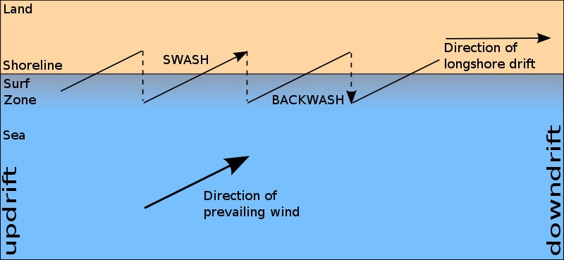
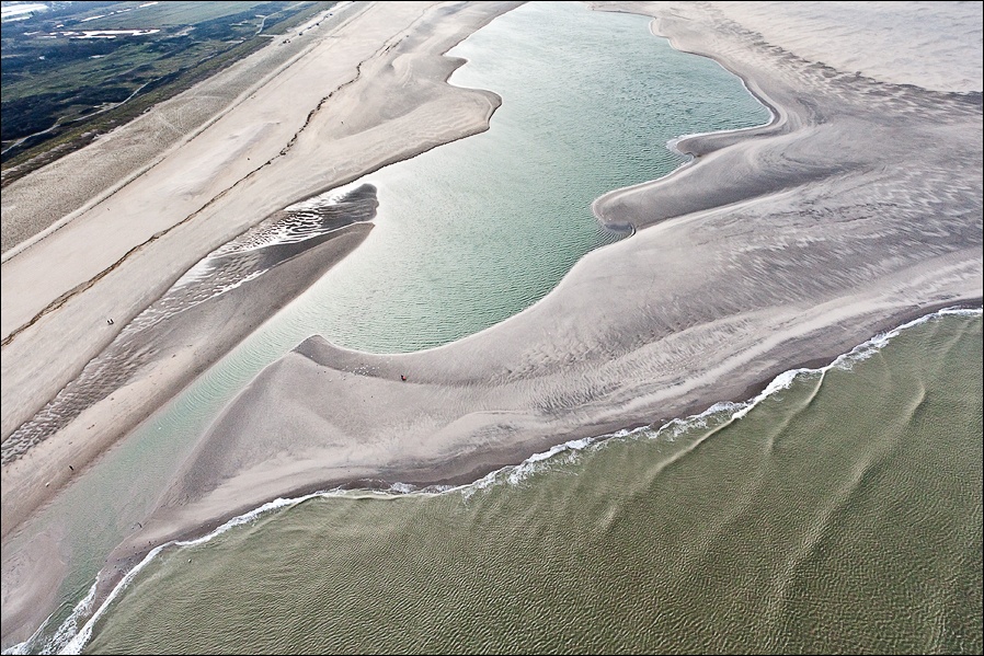
In deeper water, the wave-induced motion does not reach the bed, but in shallow water, waves and currents have the capacity to pick up sediment from the seafloor and transport them across in alongshore (also known as longshore transport or littoral drift) and cross-shore directions (Dronkers & Mulder, 2010). The ratio between the two, depends on bed topography, the direction of waves incidence and the wave asymmetry. Cross-shore sediment transport around the waterline is dominated by swash and backwash.
Waves vary spatially, the form of an offshore wave differs form that of a wave near the shore. Wave transformation occurs as a wave approaches to the shore: it gets steeper (shoaling), until it overtops and breaks. Natural wave fields are seldom uniform: they consist of combinations of wave trains with different periods and directions.
Where waves action determines the amount of sediment suspended in the water column, wave asymmetry and net currents determine the transport direction. The rule ‘waves pick up, currents transport’ is, however, an oversimplification of reality. This transport may result in local accretion and erosion patterns, or in a uniform net longshore transport. Sediment transport is the process by which dynamic coastline features, such as beaches, spits, dunes and nearshore bars, are built and maintained.
Tides are the periodic rise and fall of the water level in oceans and seas, resulting from the gravitational attraction of the sun and moon. Tides may be semi-diurnal (occurring twice a day) or diurnal (once a day). Apart from this temporal variation, tides alo vary in space, in the difference between high and low tide (vertical tide) or in the difference in current velocity (horizontal tide). Tidal regimes can be divided into microtidal (tidal range is less than 2m), mesotidal (2-4m) and macrotidal (>4m). Microtidal environments are often wave-dominated, whilst macrotidal environments are tide-dominated. In mesotidal environments tides and waves are equally important.
Sandy shores can be divided into natural compartments called littoral cells. Each cell contains a complete cycle of sediment transport, including sources, transport paths, and sinks. Sediment exchange between cells is usually limited. Littoral cells are often (but don’t have to be) separated by headlands or manmade structures such as harbours.
Ground water flow, sea level rise, subsidence and sediment balance (long term drivers)
Over longer time spans, slowly acting drivers gain a more prominent role. Dominant ones are sea level rise and subsidence, but also groundwater flow and natural sediment supply do play a role.
Groundwater flow
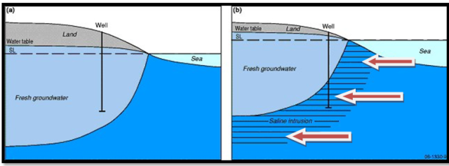
Infiltration of rain water into the sandy soil, may create a fresh water wedge under the dunes. This body of water, floating on top of the saline groundwater, is important as a barrier against a landward protrusion of salty groundwater. At the same time, it presents a local fresh water reservoir for dune flora and fauna. High ground water levels may create ecologically important ‘wet’ dune valleys. The fresh water wedge also represents an important drinking water reservoir, which is sometimes even enhanced with water from elsewhere. In that case, the sand also acts as a filter. The ground water table slowly responds to changes in morpho- and hydrodynamic conditions. Figure ‘Freshwater wedge under dunes’ shows how sea level rise may negatively influence the wedge.
Natural sediment supply
On the scale of coastal cells, structural changes of coastal morphology are governed by the delicate balance between the natural supply and losses of sediment. Reduction of the natural sediment supply may result in structural erosion of the coast. Such reduction is often associated with engineering interventions upstream a river or estuary, such as sand mining or the construction of a dam. Besides a direct impact on sediment availability, engineering measures may also affect the river flow regime by levelling peak discharges. The latter effect induces a decrease of annual sediment transport rates, hence further reduction of the natural sediment supply to the coastal zone.
Sea-level and soil subsidence
Sea-level rise, due to global warming may have a large impact on the long-term coastal morphology. Generally speaking, a coast will tend to retreat under sea level rise. Yet, the Holland coast has accumulated much sand and prograded significantly during part of the holocene sea level rise.
Subsidence is the downward motion of the surface relative to a certain reference level. Subsidence can be natural (e.g. compactions of soft sediments, tectonic activity) or caused by human activity such as mining of oil/gas, extraction of groundwater or peat exploitation.
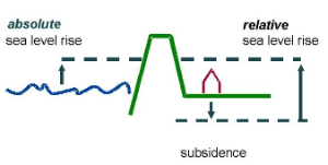
As sea level rise and subsidence have a similar effect on coastal evolution, their combined effect is generally referred to as relative sea level rise (see figure ‘Relative sea level rise’).
Ecology of sandy shores
The physical features of sandy shores reflect the interaction of wave climate (height, period and direction), tidal regime and sediment available. The resulting physical state of the shore, with aspects such as beach slope, particle size distribution, swash climate and flooding and drying of the intertidal zone, determines community structure, zonation and ecosystem functioning (Brown & McLachlan, 2002). Sandy shores serve as habitat for a diversity of phyla e.g. mammals, meio-fauna, macro-fauna and insects. They consist of zones that differ in the organisms colonizing them: the dunes, the supratidal zone, the intertidal zone and the subtidal zone.
Dunes
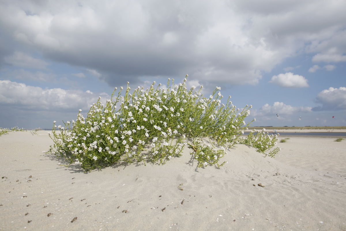
Dunes form along sandy shores adjacent to coastal lowlands. Dune formation is the result of a complex interaction between different agents: besides physical factors, vegetation plays an important role. Pioneer species provide shelter from the wind and enable sand to accumulate, while the roots keep the sand together. In this way, the first plants create small undulations on the flat beach: embryonic dunes. When the sand transport is large enough these embryonic dunes grow and the substrate becomes less salty, thus enabling other species to survive and build the landscape. Dune areas may be up to several kilometres wide and consist of different dune stadia, ranging from embryonic dunes, via white dunes to grey dunes. In the most active areas only a few species of grass and shrubs can survive. In between dune ridges, valleys may be found where trees and bushes grow; elder dunes, farther away from the coast, are also often forest covered. Humid dune slacks represent the wetland component of dune systems, usually where the underlying water table reaches the surface. When an area of the upper beach is enclosed by the development seaward of a new dune ridge, primary humid dune slacks can develop. Secondary humid slacks may originate in wind eroded depressions in older dunes. This habitat type has a particular flora and fauna and is very sensitive to desiccation. Well-developed humid dune slacks are scarce in Europe nowadays (see the natura2000 document on humid dune slacks).
The circumstances organisms in this habitat have to deal with are drying winds, low soil moisture, low soil fertility, salt spray, blowing sand and intense sunlight. Dune plants have adapted to this harsh environment by developing fleshy stems to hold moisture. Typical dune plants are Sea Rocket, the Sea Holly and European Beach Grass. The sandy soil serves as a perfect substrate for animals to burrow. Rabbits and foxes are frequently found in dune areas. Rabbits feed on dune vegetation while foxes in turn feed on rabbits. Larger animals such as deer can be encountered and the valleys and ponds between dunes provide shelter for many smaller organisms such as frogs, dragonflies, beetles and sand lizards.
Supratidal zone
The supratidal zone (also known as the supra-littoral zone or ‘dry’ beach) lies above the high tide level. It is only flooded occasionally during high spring tides and storms. The area is however regularly sprayed by seawater. Beside the salt spray, organisms are exposed to the drying heat of the sun in summer, to low temperatures in winter, to fresh rain water and to large sand deposition due to dune erosion during storms. Only a few organisms are able to survive in this harsh environment. Most animals living here burrow into the sand (macrofauna) or live between the grains of sand (meiofauna). Some are active at night in order to avoid both predators and the hot sun. During the day they bury themselves in the damp sand (e.g. sandhoppers). The salt spray limits the growth of plants in the lower supratidal zone. In the upper supratidal zone, where there is less salt spray many species of grasses, shrubs and trees grow. Organisms that are found in het supratidal zone are crustacea (crabs, shrimps), diatoms (algae), and polychaeta (worms). The dominant taxa of sandy beach meiofauna are nematodes (roundworms) and harpacticoid copepod with other important groups including turbellaria (flatworms), oligochaeta (aquatic and terrestrial worms), gastrotrichs (hairy backs), ostracods (seed shrimps) and tardigrades (water bears).
Intertidal zone
The intertidal zone (also known as the littoral zone or ‘wet’ beach) lies between the normal low and high tide levels and is alternately flooded by seawater and exposed to air as the tides come and go. The zone is characterized by high energy wave action, recurrent flooding by seawater, high sediment dynamics and exposure to air, rain and sunlight. Organisms that live here are able to tolerate a highly dynamic physical environment including strong temperature fluctuations, drying, heat stress, desiccation, oxygen depletion and reduced feeding opportunities. The majority of intertidal sandy-beach animals are tiny and live between the sand grains. No large plants grow on the intertidal zone; only microscopic algae (diatoms) are found between the sand particles. Seaweed and debris that have been deposited on the beach during high tide often harbour small crustaceans (beach hoppers). The intertidal zone also harbours other crustaceans, worms and molluscs. During high tide, seawater delivers food particles such as phytoplankton and zooplankton, eaten by numerous filter feeders such as clams and worms. The intertidal zone is divided into an upper intertidal zone, which consists mostly of scavengers of deposited material such as Talitridae (sand fleas). These in turn, are preyed upon by shorebirds and beetles, as well as unexpected predators such as foxes, raccoons, and burrowing owls. Other inhabitants are coleoptera (beetles), diptera (flies) and oligochaeta (worms). The mid intertidal zone is dominated by isopods and are preyed upon by shorebirds. The low intertidal zone is almost fully marine and exposed to the air for short periods of time. Its inhabitants are bivalves (molluscs), polychaeta (worms)and crustacea (crabs, shrimps).
Subtidal zone
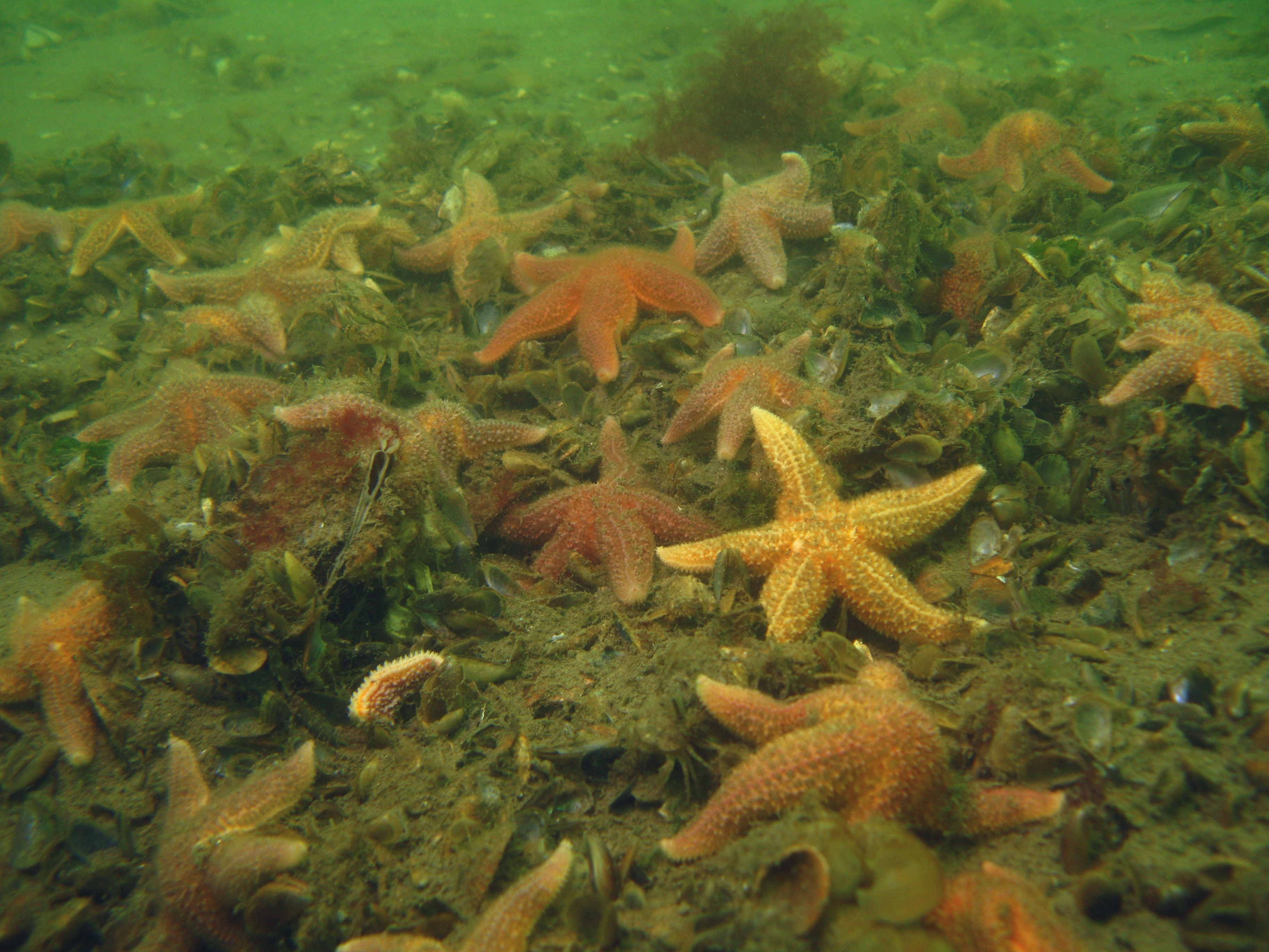
The subtidal zone (also known as the sub-littoral zone) is the permanently submerged, relatively shallow water area seaward of the intertidal zone. It is strongly influenced by waves, tidal currents and sediment dynamics. Its flora and fauna abundance and diversity depend on factors such as wave action, salinity, temperature and the import of nutrients and food, largely controlled by the degree of tidal exchange (Reading, 1996). This zone is relatively more stable than the intertidal zone, since temperature, water pressure and sunlight radiation remain relatively constant. Sediment dynamics, however, may be stronger (e.g. movement of offshore sand bars). Many organisms that live in the subtidal zone are characterised by flattened bodies, as a flat body minimizes exposure to wave impact. Flat fish such as flounders avoid turbulence by burying themselves in the sand. Other macrofaunal inhabitants are polychaeta (e.g. sand worm), oligochaeta (sand mason), crustacea (crabs, shrimp), gastropoda (snails), bivalves (clams, cockles) and echinodermata (sea stars).
Governance processes
Coastal protection from floods is often the most important function of sandy shores and dunes. Since coastal protection goes beyond local interests, usually also regional and national governance levels have a role in decision making. The Dutch coast is used as a case to identify generic key actors and the roles they play, for situations where coastal safety is the dominant issue.
In the Netherlands, maintaining the sandy coast as a flood defence system involves three government levels (Mulder & van Dalfsen, 2011):
- the national level, the Ministry of Infrastructure & Environment, is responsible for the planning and construction of flood defence systems,
- the regional level, four coastal Provinces and seven coastal Water Boards, is responsible for inspection and maintenance of these systems;
- the local level, several municipalities, is interested in the benefits and opportunities that arise as a result of the flood defence system.
The role of the national government is threefold: overall supervision, flood defence management at the Dutch Wadden islands and of the Delta dams, and coastline management of the entire Dutch coast. As an overall supervisor the State also bears responsibility for (strategic) policy. Daily management of flood defences of the sandy Holland- and Delta coasts is the task of the Water Boards. The role of Provinces is supervision of Water Boards and coordination and integration of coastal policy.
For the implementation of coastline management, e.g. the design of regular nourishment schemes, the State seeks advice from Provinces, Water Boards, municipalities and stakeholder organizations. Also civil society (NGO’s, action groups) and private users (fishermen, drinking water companies, tourist industry) influence decision making and coastal strategies. At regional and local levels, role, influence and relative importance of NGOs and private users vary from place to place.
More information on governance processes in Building with nature can be found under Governance – BwN in civil society.
Ecosystem Services
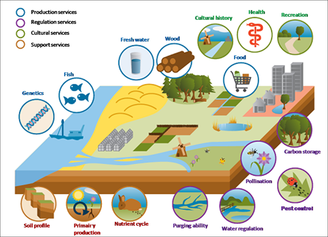
Natural ecosystems in general provide a multitude of resources and services to mankind and planet. Collectively, these benefits are known as ecosystem services. The issue of ecosystem services has been discussed for decades. In 2004, the United Nations Millennium Ecosystem Assessment (MEA) divided the ecosystem services into four categories;
- provision, such as the production of food and water, or the availability of mineable resources;
- regulation, such as the control of climate and disease;
- cultural, such as spiritual and recreational benefits; and
- support, such as nutrient cycles and crop pollination (TEEB). For further reading on ecosystem services see here.
Provision
Provision concerns natural resources, including products that a society gets from ecosystems. Examples of products that are provided by sandy shores are:
- Fresh water, as rain water filtrates into the dune sand, creating a fresh water wedge.
- Food, such as fish, shellfish etc. Shallow coastal areas are also important nursery areas for a variety of species.
- Construction materials: beach sand is often collected for construction works; some types of grass have traditionally been used for weaving household utensils; wood from dune forests is used.
- Alternative energy resources, derived from e.g. wind, waves, tides, algae.
Regulation
These are benefits that arise from how a system regulates processes, resources and its own properties. Benefits obtained from regulation by sandy shores are:
- Coastal protection; against flooding and erosion. Beaches attenuate waves, dunes act as a barrier and as a sand buffer. Wind-blown sand transport gradually restores dune fronts that have been eroded in a storm. Natural dune vegetation actively promotes the development of dunes by trapping wind-blown sands. In the Netherlands dunes are actively managed as a primary flood defence.
- Water regulation, as dunes have high potential for storage and purification of water.
- Sediment transport, natural processes (e.g waves, tides) facilitate the transport of sediments and enable the coast to assume its natural alignment after being disturbed.
Cultural
These are non-material benefits people enjoy. Examples of the non-material benefits obtained from sandy shores are:
- Tourism and recreational activities, such as swimming, surfing, sailing, canoeing etc.
- Research and education: coastal systems are important subjects of scientific research; experimenting with coastal defence systems enables finding new solutions and at the same time improves the understanding of the system’s functioning and extends the generic knwoledge base.
- Aesthetic value: the appreciation of beaches and dunes make sandy coasts an attractive living environment; this may manifest itself in higher real-state prices close to the coast.
- Reflection & spiritual enrichment.

Support
Some processes are necessary to enable the other three categories, without yielding direct benefits to humans (e.g. sustaining critical ecosystem processes that determine the vitality and resilience of ecosystems). Examples are:
- Habitat provision for animals and plants.
- Refuge and forage area for different species such as wading shorebirds.
- Sediment transport (longshore and cross-shore) maintaining and stimulating the development of beaches and dunes.
- Wave dissipation: beach and foreshore attenuate waves, thus providing for quiet conditions further shoreward.
- Soil formation and retention for the development of dunes.
- Water cycling resulting in the production of fresh water as a production service.
- Resilience to human impact and climate change: recovery after natural (dune erosion, storm surge, tsunami) or human-induced disasters (oil spills).
Building with Nature opportunities
Building with Nature for sandy shores involves measures or interventions that optimize the use of ecosystem services to achieve new functionality, sustainability and new opportunities for nature. This implies changing from traditional management (MacHarg, 1969) – focusing on a single goal and ignoring other aspects, especially supporting ecosystem services – to a more adaptive management which accounts for the complex and dynamic nature of the sandy shore ecosystem, including all four types of ecosystem services.
Since the balance between net supply and demand of sediment determines the long-term development of a sandy coast, an obvious opportunity for a Building with Nature approach is the use of sand nourishments, aiming at maintaining the coast by exploiting a supporting service (sediment transport) and at the same time promoting nature development.
The nourishment scheme adopted should optimally enhance the regulatory (e.g. coastal protection), production (e.g. biomass production feeding into the food web) and cultural services (e.g. stimulating tourism and recreational activities and the appreciation of beaches and dunes). Traditional management often focuses on the scale and periodicity of coastal erosion processes only. A Building with Nature approach, however, should aim at optimizing management actions in relation to all system functions and services.
The historic evolution of coastal management in the Netherlands is an example of gradual transition from a traditional approach to a Building with Nature type one (Van Koningsveld et al., 2008). Innovative nourishment strategies, including high-frequent, single point schemes on the basis of permanent infrastructure will allow for further optimization in the near future.
Sustainable coastal development
The Dutch sandy shore is a highly valued ecosystem. Protecting the hinterland against flooding has always been seen as its primary function. Traditional coastal management therefore focused on preserving and strengthening this regulation service. Since 1850, the coastline has been actively maintained. Hard structures such as dikes, revetments and groins were used to mitigate coastal erosion. Where dunes eroded during storms, they would be restored with sand that was kept from being blown away by planting European beach grass (helm). In fact, this was an early form of building with nature (ref.) Later on, the frontal dune ridge was closed artificially and kept fixed in order to secure the coastline; erosion was followed by dune nourishment. This practice, however, negatively impacted the system’s natural behaviour. Reduced dynamics resulted in reduction of biodiversity, especially in the dunes, where pioneer vegetation and associated organisms are scarce, anyhow. Due to the fixation of the frontal dune ridge, natural processes such as colonization and succession were hampered.
In 1990 a new coastal management strategy was adopted, based on maintaining the overall sand budget in a certain zone of the sandy shore system. Sand nourishments of beach and foreshore are the preferred measures to achieve this. “Restoring natural dune ridge processes and associated habitats while ensuring flood protection” is the overall objective. This approach yields a more dynamic system using the regulatory ecosystem services of aquatic and aeolian transport to redistribute the nourished sand over the system, including the dune area and the lower shoreface. This allows a more natural evolution of the coastal profile and the dune area, including the biotic ecosystem. At suitable locations, even breaching of the frontal dune ridge is allowed, in order to restore natural dynamics. The results is a variety of succession states, from pioneer vegetation to climax communities.
Traditional versus Building with Nature approach
Nourishment is maintenance, it does not remove the causes of erosion. Consequently, certain parts of the coast need to be re-nourished from time to time. Such re-nourishments take place at intervals of typically 4-5 years and their volumes vary between 1 and 7 million m3. This means that, the beach and the shallow foreshore there are disturbed at a time scale similar to the time needed for full restoration of the local ecosystem. Moreover, natural biological cycles (e.g. spawning and breeding seasons) are not always taken into account when planning these sand nourishments, which may enhance their impact on the ecosystem. Although more research is needed to assess this effect, these repeated nourishments may bring the ecosystem into a more or less permanent state of disturbance.
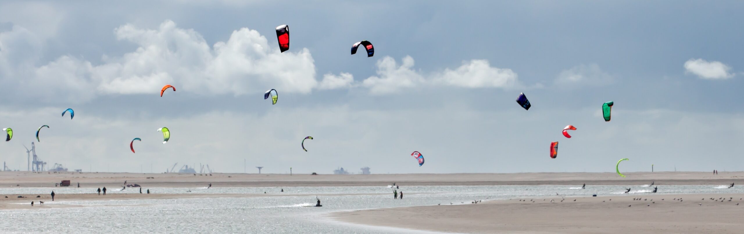
Although the policy of dynamic coastal management is primarily associated with safety, the principal measure, shore nourishment, is a good starting point for nature development. Mega-nourishments, with a multiple of the amount of sand involved in present nourishment practice are expected to yield a more natural evolution of the coastal profile, to enhance the dune area and to allow the ecosystem more time to recover. Moreover, they offer interesting perspectives for recreation and nature development. The Sand Engine, for instance, turns out to be a very popular kite-surfing site and an attractor for beach recreation. Recently, the Frosted Orachle was found there, a rare beach plant in the Netherlands, where it is only found in Zeeland and in the Wadden Sea area. Another example is the Hondsbossche and Petten sea defence. This used to be a traditional sea dike, but a mega nourishment has changed the area into a wide beach with new dune habitat.
Lesson Learned
The lessons learned are derived from the pilots and historic cases addressed in the Holland Coast subprogramme. Further additions will be made as more results become available.
Physical processes
- Using the coastal hydrodynamic forces, such as wave- and current-driven sediment transport, concentrated nourishments are able to feed larger coastal cells.
- Sediment transport and especially the location of erosion and accretion zones can be actively steered by larger nourishments.
- At the Sand Engine project, the observed morphological behaviour was qualitatively consistent with pre construction predictions, albeit that measured changes occurred faster than predicted. This was attributed, among others, to stormy conditions during the first winter and a offset initial bathymetry.
- Owing to a large gross deposition of sediment to the north and the south, symmetric development of the coastline around the Sand Engine is observed.
- The migration speed of a mega-nourishment at the Holland Coast is about a few 100 m’s per year; this analysis considered the center of the mega-nourishment as the location with the largest distance from the original coastline.
- Storm events could have a significant effect on morphological evolution. Numerical predictions have shown that extreme storms with return periods of 20 – 100 years have a similar morphological impact as 6 – 8 months yearly-averaged conditions.
- The morphological evolution of concentrated shoreline connected nourishments (small-scale and large-scale) is dominated by (gradients in) alongshore processes.
- The morphological evolution of foreshore nourishments (small- to medium-size, on the scale of sand bars) depends on the combination of cross-shore and alongshore processes. Within several months, cross-shore processes induce a rapid adjustment of the sand bar topography (nourishment becomes outer bar, existing bars migrate inshore); in the years after, sediment (supplied by littoral drift) is trapped in the ‘shelter zone’ behind the nourishment to result in beach widening.
- The findings above affect nourishment design. If the design foresees in a specific grain size diameter on the beach, this can only be achieved through a beach or at least shore-connected nourishment; if the design foresees in a ‘natural grain size’ on the beach, this can best be realized through a foreshore nourishment as there is no direct link between the nourished sand and the material found on the beach.
Ecological processes
- Shore nourishment is not only useful for coastal safety, but can also come with benefits for nature development and recreation.
- Since frequent disturbance of large parts of the beach and foreshore creates a negative impact, less frequent but larger strategically placed mega-nourishment may be a better strategy. This was one of the aims of the Sand Engine project.
- An other objective of the Sand Engine was to study whether large-scale nourishment can be designed such, that they enable new nature development. Results are not known yet at this stage (2012).
- Short after a nourishment opportunistic animals, like those worms that live in between the sand grains on the beach, will re-occur. This, however, does not mean that full recovery of the beach ecosystem has occurred. This will probably take many more years.
Governance processes and societal processes
- Focus on the main driving forces: flood safety, beach quality and nature. These should therefore be the starting points of design criteria for nourishment strategies and of the design of each individual mega-nourishment.
- Large-scale shore nourishment is multifunctional and require cooperation between coastal management authorities, nature organisations, recreational industry and dredging contractors from the early development stages on.
- Gradual changes of ‘their’ local shoreline are often more acceptable for local communities than abrupt ones.
- The costs of coastal management can be reduced by smarter strategies but also by smarter contracts, enabling contractors to provide their services in the most cost-effective way by planning ahead and making opportunistic use of equipment availability.
- The ad-hoc construction of a temporary dam across the feeder channel (to ensure swimmer safety, May 2012) demonstrates:
References
Literature
- Komar, P. 1983. CRC handbook of coastal processes and erosion. CRC.
- van Koningsveld, M., J.P.M. Mulder, M.J.F. Stive, L. van der Valk and A.W. van der Weck, 2008. Living with Sea-Level Rise and Climate Change: A Case Study of the Netherlands. Journal of Coastal Research 24(2): pp. 367-379. doi:10.2112/07A-0010.1
- MacHarg, I, 1969. Design With Nature.
- Mulder, J.P.M, J.A. van Dalfsen, 2011. Current challenges in coastal management in the Netherlands; examples of pilot projects. Coastal Engineering Practice 2011, ASCE 2011.
- Reading, H.G., 1996. Sedimentary environments: processes, facies, and stratigraphy. John Wiley & Sons.
- Widdows, J., M. Brinsley, 2002. Impact of biotic and abiotic processes on sediment dynamics and the consequences to the structure and functioning of the intertidal zone. Journal of Sea Research 48: pp 143 – 156.
Internet
- Coastal Morphology Group, Scripps Institution of Oceanography. Date of access: 3rd March 2012.
http://coastalchange.ucsd.edu/st3_basics/littoralcell.html
- Coastal wiki. Date of access: 3rd March 2012. http://www.coastalwiki.org/coastalwiki/Sandy_shores * Integrated Guidance for tidal Shorelines.
- Center for Coastal Resources Management, Virgina Institute of Marine Science. Date of access: 3rd March 2012. http://ccrm.vims.edu/coastal_zone/integrated_guidance/
- Marine Diversity Wiki. Date of access: 3rd March 2012. http://www.marbef.org/wiki/Sandy_Shores
- United States Army Corps of Engineers. Date of access: 3rd March 2012. http://www.lre.usace.army.mil