Planning and design
Pre-feasibility
The first design of the project was created through a number of workshops. All parties involved contributed to in five creative ateliers. First an analysis of the area was made and secondly a revitalization strategy was developed. This approach kick-started the project and within three months an initial design had been made.
To release the creativity needed for an innovative design, it was necessary for the different parties to be open-minded and to give up their own preset ideas. Under the guidance of an independent panel chairman and in accordance with the principles of urban and rural development planning, this creativity resulted in an innovative and jointly supported plan.
From the beginning of the project, the public was regularly updated and asked to participate in the process. Communication with the local people stimulates their commitment to the project, even though it may take a lot of time.
Design
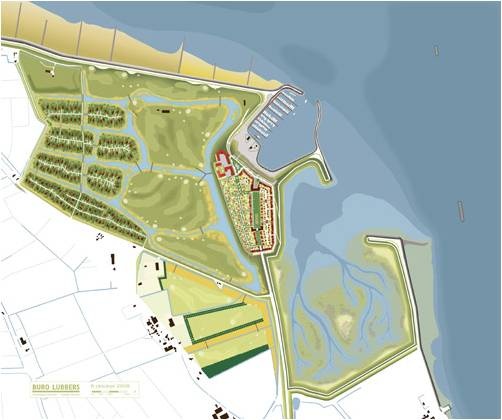
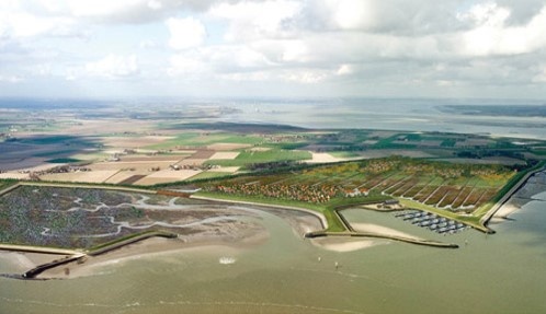
The design of the Perkpolder project is part of an integrated regional development plan in which flood control, environmental and socio-economic factors are included in the design. The design consists of residential, recreational and nature areas. In the center of the area an exclusive residential complex will be created on top of a landfill. More recreation will be created by a marina, holiday residential units in the polder, an upgrade of the beach and a golf course. A nature reserve will be created in the east of the polder. Between the breached old dike and the new one a saltmarshes area will develop.
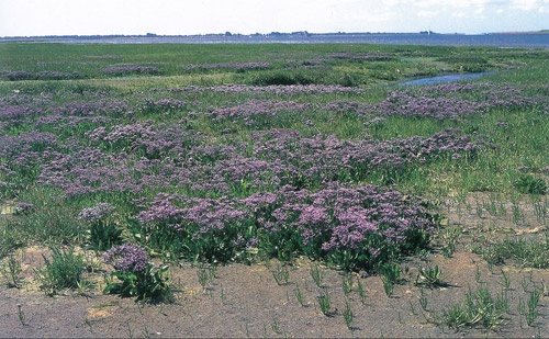
An integral part of the design is an innovative flood protection scheme that should provide protection for at least 50 years. The new dike, with landfills and beach upgrading, will protect the polder’s inhabitants from flooding. Furthermore, the saltmarsh area will form a water storage buffer in front of Perkpolder. As this saltmarsh will regularly be flooded with sediment-laden sea water regularly, the marshes will gradually grow higher by sediment trapping (cf. the adjacent Land van Saeftinge, a saltmarsh area that has risen to the highest natural piece of land in the area). Thus the saltmarsh is expected to be able to keep up with the sea level. Shallowness and vegetation in the area will attenuate incoming waves, thus reducing wave attack on the dike. In the present design the western part of Perkpolder is reserved, such that the main dike can be raised in the future.
Feasibility
In the feasibility phase a feasibility study by landscape and real-estate developers was carried out, as well as a cost-benefit analysis. The latter showed that the project would add value to entire region. The creation of nature would positively affect the residential and recreational value; new jobs would be created and the environmental value would increase. The outcome of this analysis gave the various public entities a positive impulse to commit themselves to the realization of the project.
Governance
A joint communication strategy mainly focused on the broad public was part of the project. A sounding board included representatives of relevant social groups. Moreover, the local population was informed via information evenings, the project website and the Municipality’s newspaper.
BwN aspects
The design procedure for the Perkpolder project led to a multi-functional design with due attention for the natural component. The flood protection scheme with the dike realignment and the adaptive saltmarsh is an example of building with (and to a certain extent by) nature.