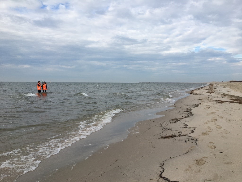
On the sandy outer banks of the Marker Wadden you will find not only birds and hikers, but also researchers who work their way through the surf in dry suits or wetsuits. What are they doing there?
The research on the beaches of the Marker Wadden is part of LakeSIDE (Lake Shore Interconnecting Defense and Environment), a project of the Delft University of Technology that is financed by Rijkswaterstaat. LakeSIDE is researching sandy beaches in environments without high waves and tides, such as in Markermeer and IJsselmeer. The research is not only carried out on the new sandy reinforcement of the Houtribdijk, which is the reason for the research, but also on the Marker Wadden where these beaches are already present. LakeSIDE is in fact part of Rijkswaterstaat’s research and monitoring program for efficient and effective management and maintenance of the sandy reinforcement. Part of the research on the Marker Wadden is being done in collaboration with KIMA (Knowledge and Innovation programme Marker Wadden).
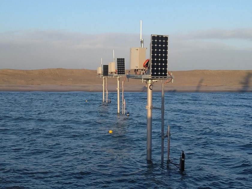
The researchers struggling through the waves on the Marker Wadden have a pole with a GNSS (also known as GPS) on them, with which they monitor the bottom height every three months along the beach and under water (Figure 1). In addition, since February there have been a number of monitoring posts with various instruments along the Zuider- and Noorderstrand of the Marker Wadden, with which waves, currents and the ground height are measured at fixed points (figure 2). With all the information that is collected in this way, we can get a good picture of the development of the sandy shores and the role of the waves and currents therein.
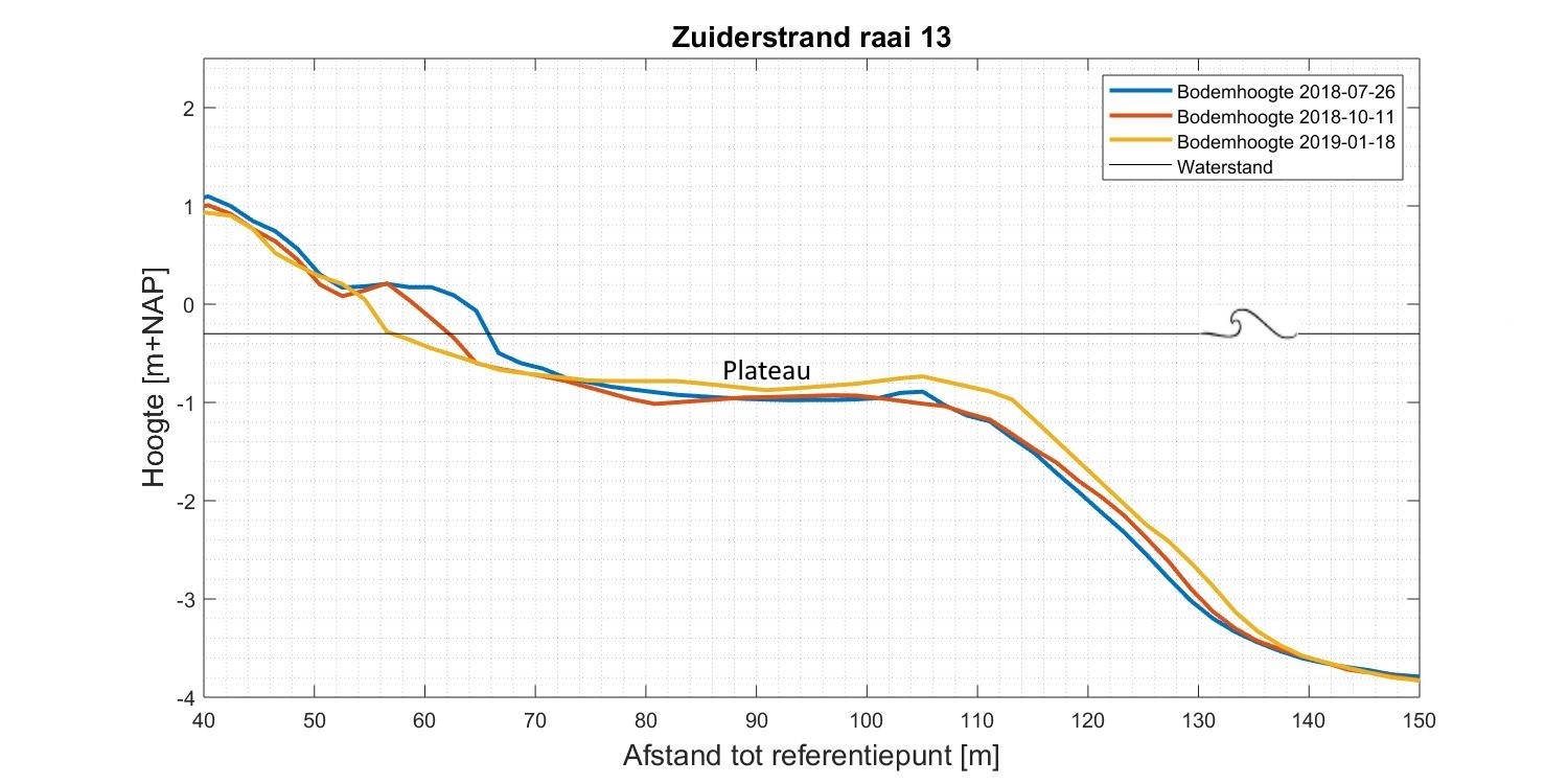
The first measurement results show that the overall shape of the Noorderstrand, Recreatiestrand and Zuiderstrand is very similar, but that the development of the three beaches is different. If you look at the transverse profile of the bottom level, as in Figure 3, the characteristic shape is clearly visible. The beach has a steep slope around the waterline, which overflows around -1 m NAP into an almost horizontal “plateau”. This plateau flows into a steeper slope, which in turn connects to the original bottom of the Markermeer. You can see this form on all three beaches of the Marker Wadden, although details differ. The development of the three beaches also differs in terms of erosion and sedimentation. The Zuiderstrand is located on the southwest and is therefore often exposed to storms. This is therefore the only beach where erosion has been seen around the water line over the entire measuring area since July 2018. The future will have to show to what extent this is a structural trend.
Optimize maintenance
The monitoring campaign will run until at least 2022. In this way we will gather a lot of interesting information about the sandy shores of the Marker Wadden and the Houtribdijk in the coming years. In this way we hope to better understand and predict the development of these types of sandy shores and to optimize maintenance.