Overview
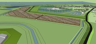
Location: Noordwaard near Werkendam, the Netherlands
Date: 2009 – 2015
Involved parties: Deltares, WINN, Rijkswaterstaat Room for the River program, Project bureau Noordwaard, Waterschap Rivierenland
Technology Readiness Level: 2 – technology concept formulated
Environment: Lakes, Rivers & Estuaries, Cities
Keywords: wave reduction, willow forest, dike height, room for river, safety level
| Building with Nature design | Traditional design |
|---|---|
 | 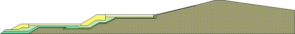 |
| The hybrid dike is integrated in the landscape because willow trees are common in the area. The armoured dike is now replaced by a lower clay covered dike resulting in a cheaper solution. The combination of a clay dike and willow plantation is generating additional natural and landscape values. In line with sustainability objectives of the Dutch government, production of biomass for energy as result of regular maintenance of the willow plantation is seen as a bonus of the project. It is expected that the new design will add to recreational value of the area for local residents. | The dike has been optimized from a landscaping point of view. On the land side (right hand side of profile drawing) the slope is very gentle in order to provide an impression of a sloping meadow for the residents of Fort Steurgat. The traditional design on the side exposed to high water levels and wave impact is fortified with a concrete armoring layer to resist waves with a significant wave height (Hs) of 1.1 meter. |
Abstract
Within the national Room for the River programme the polder Noordwaard was being prepared to function as an extra river branch of the Nieuwe Merwede river in times of high discharge. The aim was to lower water levels upstream of the new branch considerably, in order to protect the city of Gorinchem and the surrounding areas against flooding.
A new primary river dike is required in the North Eastern corner of the Noordwaard to protect the inhabitants at Fort Steurgat. During a 1/2000 year discharge event the average water depth in the polder will be 3 meter whereby, in combination with a severe storm, waves up to 1 meter high are expected near Fort Steurgat. A first ‘traditional’ dike design around Fort Steurgat resulted in a dike height of 5.5 meter above NAP, with concrete blocks as armouring layer, leading to protests from the local population. Therefore, the aim was to create an ecodynamic design that provided safety, additional values for nature and recreation and is durable and cost effective.