How to Use
General
If an ecosystem engineer is considered to be included in a design for coastal protection or coastal rehabilitation, several questions need to be answered:
- Is it possible to create a suitable habitat for one or multiple ecosystem engineers in the project area?
- What would be the envisaged services provided by this ecosystem?
- To what extent can the ecosystem contribute to the (protection) function of the design and how does this affect the design itself? For example, what dimensions of a seagrass meadow are needed to reduce erosion or stabilize sediment? Or: at what water depth is a coral reef an efficient wave dissipator? What is the impact of this ecosystem engineer on the existing physical, ecological and socio-economical system?
- What are the costs and risks of including such ecosystem engineers in the design?
The determination flowchart gives a first answer to the suitability of a certain habitat for seagrasses. Other questions can be elaborated in subsequent or parallel steps.
Determination Flowchart
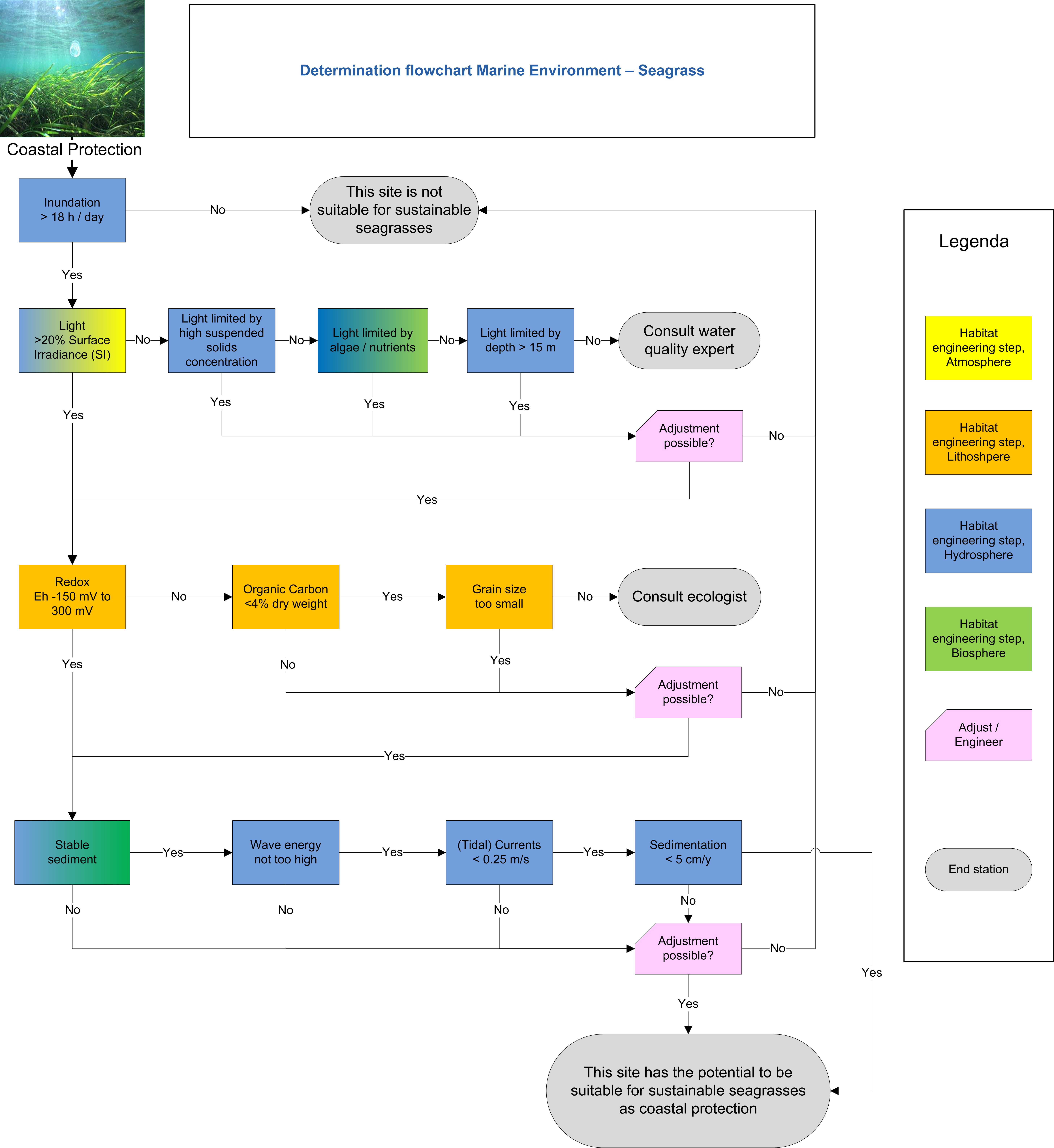
The determination flowchart is based on the habitat requirements described in the previous section. It comprehends the conditions needed for (natural) establishment of seagrasses. Its function as coastal protector requires the ecosystem to be sustainable and robust. The goal of the determination flowchart is to give an easy, approachable and low-cost indication in an early stage of a project, whether a suitable habitat for seagrass exists or can be created. It can also be employed to determine if restoring or improving existing seagrass meadows is an option, as it can indicate what the problem could be if seagrass development stagnates.
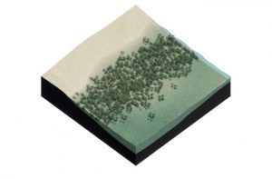
The potential ecosystem services of seagrass are:
- Coastal protection, e.g. erosion control and storm and flood protection by reducing wave attack;
- Water quality improvement through filtering nutrients and contaminants;
- Light penetration improvement and turbidity reduction by sediment trapping;
- Forming a sustainable barrier able to follow (relative) sea-level rise by sediment trapping.
Other ecosystem services, such as the provisional (e.g. food), cultural and supporting services are not evaluated here.
Current system
Before employing the flowchart it is important to consider which (eco)system is present in the current situation and which function(s) it holds. Creating something new always comes at the cost of what presently exists. If a certain ecosystem is present, like a tidal flat, coral reef or salt marsh, it is necessary to look closely at the present situation to prevent degradation. On the other hand, combined ecosystems may even enhance each other. As coral reef, for instance, can dissipate wave energy and give shelter to a seagrass meadow in its shadow. An analysis of the current system should therefore also include adjacent systems. This also applies in longshore direction, as coastal protection works usually have a large influence on the sediment budget, hence on the adjacent coast.
It is important to keep in mind that a present (eco)system may be providing other functions, such as cultural or supporting services, which may be lost by constructing something new. For example: creating a seagrass meadow might be less attractive in a recreational area where people swim. If losing the current functions is considered acceptable in return for a (new) seagrass meadow that provides the same or other ecosystem services, the determination flowchart can be utilized.
The goal of the flowchart is to provide an initial assessment to answer the following question:
‘Does the intended project area have potential to (re-)establish a sustainable seagrass meadow?’
The flowchart aims to provide an initial indication as the dynamics are too complex to comprise in a generic tool. If the flowchart indicates potential, an expert should be consulted to allow for more detailed knowledge to incorporate seagrasses in the engineering stage of a project.
Interpretation
Note that under the ‘Practical application’ tab comments are available on the values to be used when going through the determination flowchart. Every seagrass species has evolved in and adapted to slightly different circumstances, so the threshold values given in the flowchart are indicative for the majority of species and need to be interpreted for the specific location. Every location is unique with its own parameter dynamics, which makes it difficult to give absolute thresholds. A particular parameter to keep in mind before starting the flowchart is the latitude of the project area, i.e. whether it is located in a temperate, subtropical or tropical climate zone. This has implications for the species present, not only due to the light availability (hours of daylight and light intensity), but also in relation to the temperature of atmosphere and water column and the forcing weather conditions.
Another aspect to consider before using the flowchart is the historic ecosystem presence in the area. If seagrasses meadows were present in the past but absent in the present state, the history of the area is important to determine the cause of disappearance and the chances of successful future re-establishment. Examples of possible causes are infrequent large-scale climatological events, historic or current forms of (anthropogenic) pollution, intensive seabed-disturbing fisheries, harbour development, etc.
Seeding
The formulation of habitat requirements concerns the natural establishment of seagrasses. In case the natural establishment is considered impossible due to the lack of natural seeding or shooting, the plants can also be seeded. Note that, in addition to the critical habitat requirements that have be present anyhow (see flowchart), there may be additional requirements for the germination of seagrass seeds. For example, seedlings need lower energetic conditions for settlement than established seagrasses for expansion through lateral shooting.