Overview
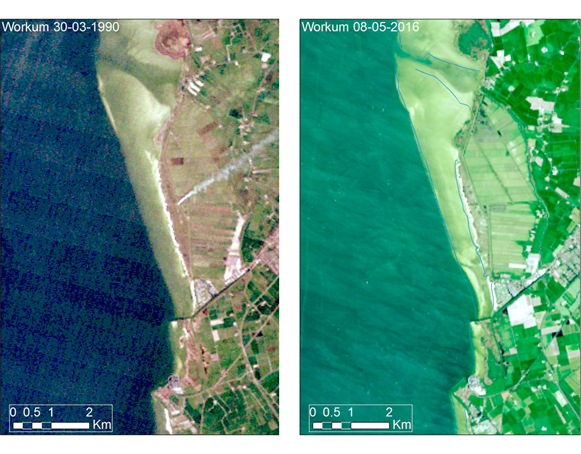
This tool aims to use observed morphodynamical changes of any coastal system during the last 30 years to predict future morphological effects to coastal interventions. This is done by the analysis of LandSat satellite imagery using Google Earth Engine. This platform enables quick selection and analysis of satellite imagery, using Google storage space and processing capacity. Since the first useful LandSat imagery was recorded in the early 1980’s, over 30 years of imagery is available for every place on earth. By first assessing past morphological changes along the coast where intervention is planned, the morphodynamical system can be understood and predictions of future effects to interventions can be better predicted. These observed changes in the past also provide a valuable dataset to test the performance of models.
Type: Method
Project Phase: Planning & Design
Type of assessment: Monitoring
Purpose: Predicting coastal morphodynamics in response to interventions
Requirements: Python programming skills, GIS, knowledge of natural processes
Relevant Software: Google Earth Engine, GIS