About
Traditionally, monitoring requires regular visits of project sites in order to assess e.g. changes in bed level, the number of birds, or the (re)colonisation by benthic animals and vegetation. Most tidal flats however, are difficult to access and therefore expensive to visit, especially in averse weather conditions. Consequently, the monitoring frequency may be too low to capture the relevant dynamics of the system. Additionally, field monitoring methods tend to focus on one system component at a time, i.e. birds are counted at a different time than benthos is sampled or the bathymetry is measured. This makes it more difficult to interpret the data in terms of relations between these components. As an alternative, remotely controlled and continuously operating monitoring systems can provide valuable, comprehensive and high-resolution information about the development of intertidal areas.
Tool description
The ArgusBio monitoring station uses multiple geo-referenced cameras to observe the environment. Listed below are the layout and settings as used to observe the dynamics of the Tidal flat nourishment – Galgeplaat, NL in the Eastern Scheldt, the Netherlands (note: station removed 2012 at the end of the Galgeplaat project). Note that the system was built early 2009; nowadays cameras with better specifications are available at the same cost. Also note that different locations and/or different interests might ask for different equipment.
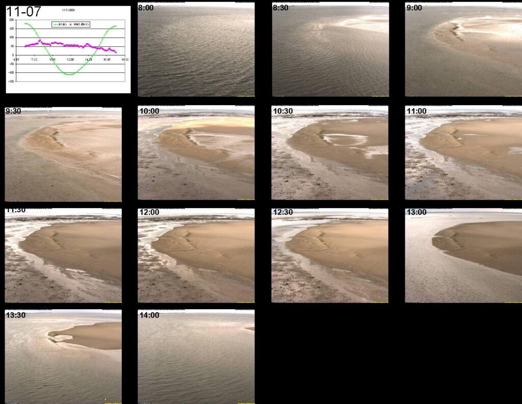
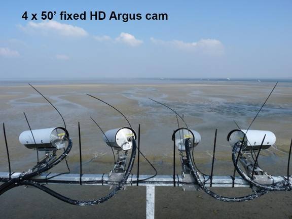
- 4x Traditional Argus cameras (fixed position, 1.2 megapixel) make time-exposures (pictures at multiple time-steps merged into one) every 3 minutes to observe changes in bathymetry, inundation time and surface soil moisture. The field of view of these cameras covers the nourishment and its close surroundings, i.e. an area of roughly 500 x 500 m. Due to the oblique orientation, the resolution close to the station is much better than farther away. The latter is too low to recognize birds, for instance.
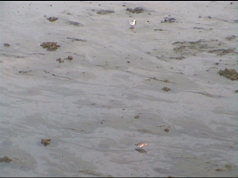
- 1x Pan/tilt/zoom camera (security camera, 0.5 megapixel) that scans five areas of interest of 50 x 50 m, all 50-150 m from the station, every 15 minutes during low water. The main objective of this camera is the observation of birds from day to day and during a tidal period. Close to the station the resolution is even sufficient to observe lugworms.
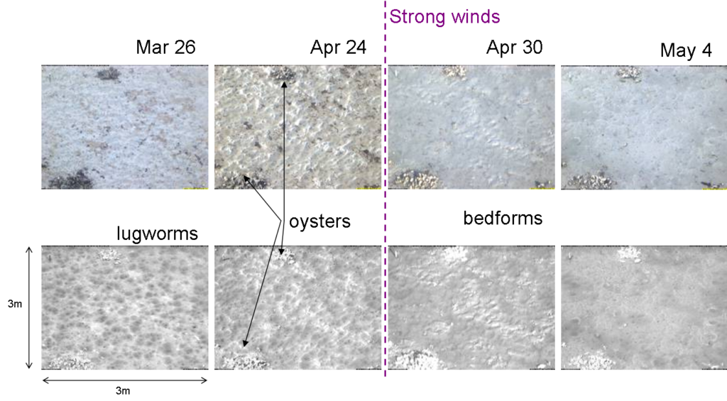
1x Multi-spectral camera with one RGB-sensor (red, green, blue; normally visible light) and two NIR (near infrared) sensors pointed at a fixed area of 4 x 4 m very close to the station to observe macroalgae, diatoms and macrofauna. The NIR sensors enable the identification of chlorophyll-a, a component that distinguishes algae from other features such as a bare bed or bivalve shells. Images are taken every half hour, theoretically enabling the quantification of diatom abundance throughout a tidal period. So far, only daily values have been used.
All these cameras are fixed in waterproof housings on a 15 m high platform mounted on a steel pile of 1 m diameter, which was drilled 12 m into the sand. The station is also equipped with solar panels and batteries for power supply, a water level sensor, a lightning conductor, a thermometer, a computer for data acquisition and equipment for data storage and communication. The data produced by ArgusBio are essentially geo-referenced JPEG-pictures (or movies), saved in the Argus-database together with information on time and camera settings. Interpretation of this data requires a substantial amount of human labour or algorithms for automated recognition. Tools have been developed for the automated recognition of shorelines, the detection of wet, dry or moist areas, birds and microphytobenthos (diatoms). See ‘practical applications’ for more information.