Construction
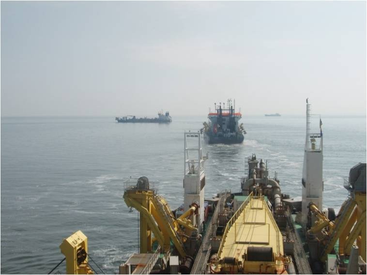
After the planning phase, the actual dredging and creation of the sand bars started. Several trailing suction hopper dredgers (TSHDs) were involved, systematically following each other to deepen the projected troughs. The sand bars, resulting in between the two troughs, are 700 m long and have 70m wide crests. The dimensions of the bars and throughs are similar to those of natural sand ridges.
Execution of the works
The following steps were taken:
- The bathymetry and sediment characteristics in the sand extraction site were studied and together with the contractor PUMA, locations within the sand extraction site were determined.
- Based on expert judgement concerning hydrodynamical, morphological and ecological aspects, a choice was made for the preferred two locations. In both cases, sand bars were positioned near the edges of the sand extraction site to add an extra slope and trough in the overall design.
- Before the construction of the sand bars, a temporary exemption became active in the near proximity of the designated sand bar extraction site.
- The design was integrated into the GIS system used on board the dredging ships. This system includes bathymetry and sediment composition data and enables calculating dredged volumes. The information from this system was used to fine-tune the design for optimal working conditions.
- The final locations were integrated into the THSDs’ GIS systems and the captains received instructions on how to dredge around the sand bars.
- The temporary exemption was abolished and the trailing suction hopper dredgers were asked to create the sand bars.
The pilot experiment took place in the sand extraction site used for the development of the Port of Rotterdam enlargement ‘Maasvlakte 2’ (MV2). Between 2008 and 2012, 220 million m3 was extracted from a 20-m deep area south of the Euromaasgeul shipping lane. A large northern extraction site is separated by an exclusion area consisting of clay and a southern smaller extraction site.
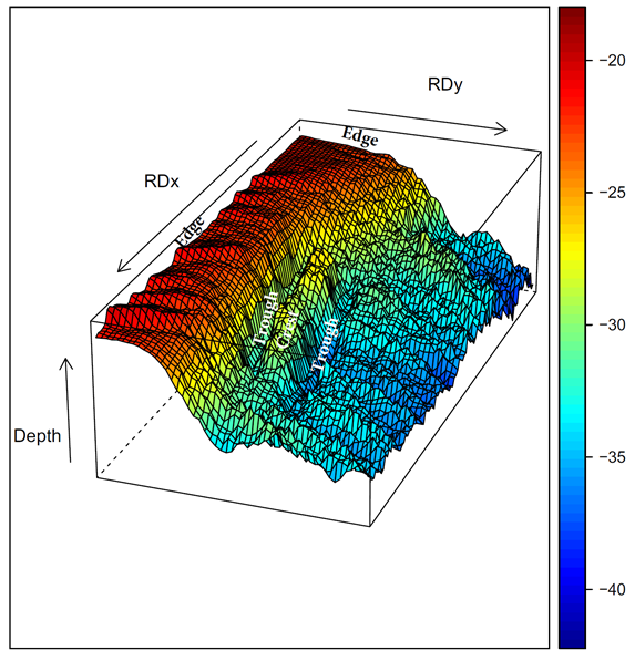
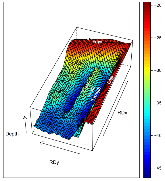
One sand bar, parallel to the tidal current, was dredged out the seabed in 2010 in the north-western part of the northern sand extraction site and one sand bar oblique to the tidal current in the south-western part in 2011.
Several trailing suction hopper dredgers (TSHDs) were involved, systematically following each other to deepen the projected trough. The dredging activities mainly took place during slack tide. Normal dredging occurs in line with the tidal current and filling of the hopper occurred when sailing from the northern to the southern part and vice versa. Changes in the dredging direction can induce constraints with regards to lateral deviation of the trailing arms and the drag heads.
The sand bars, resulting in between the two troughs, are 700 m long and the crests are 70 m wide at a water depth of 30 m. The water depth of troughs surrounding the parallel sand bar is 40 to 44 m. The troughs of the oblique sand bar are at 32 m water depth. These dimensions are not different to those of natural sand ridges.