Overview
Location: Melbourne, Australia
Date: 2003 – 2009
Involved parties: Boskalis, Port of Melbourne Corporation
Technology Readiness Level: 9 – actual system proven in operational environment
Environment: Rivers & Estuaries, Cities, Ports
Keywords: Adaptive Management, Adaptive Monitoring
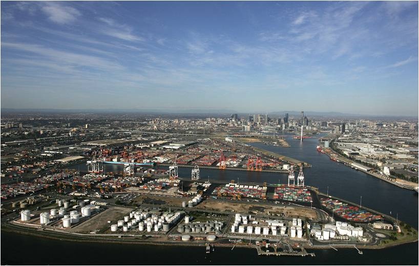
The Port of Melbourne is the largest port in Australia, managing 37% of all Australian container traffic, with the ambition to increase container handling fourfold from 2 million at present to 8 million in 2035. In order to achieve this expansion, it is necessary to extend the port and deepen the entrance and navigation channels leading to it.
From the very start, it was clear that the environmental component of the project was essential. The Port Philip Bay measures approximately 2,000 km2, has a coastline of 264 km and is home to two marine national parks. Many local residents had serious concerns about the impact of the work on biodiversity in the bay.
Project scope
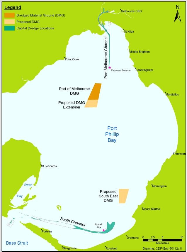
In order to maintain the position of the Port of Melbourne as Australia’s largest container and general cargo port, the Port of Melbourne Corporation (PoMC) proposed a plan to make the port accessible for 14m drought vessels during all tidal phases. The project scope includes modifications to the Great Shipping Channel at the Entrance to the Bay, the South Channel, the approach channels to the Port and the Yarra River Channel.
The Port of Melbourne is uniquely located on Port Phillip Bay. It is the habitat for a range of fish species, small penguins, whales, dolphins and seals, as well as extensive sponge gardens, various cold-water corals and seagrass beds. For approximately 3 million local residents, it is an important recreational area. Due to this unique and sensitive environment, the deepening of the Port of Melbourne included significant environmental risks.
In order to share the risks and optimize the solution, the Port of Melbourne Corporation chose early in the project for an alliance contract with a dredging contractor. By means of this agreement, all risks and profits of the project were equally shared between the PoMC and the contractor. After signing an Alliance Agreement with PoMC, Boskalis became an active partner of assisting PoMC in several necessary studies.
Environmental permits
In order to reduce the environmental risks of the project and to obtain the environmental permits, extensive investigations on technical and ecological aspects of the project were carried out.
To get the permit for the project, an Environmental Effects Statement (EES) about the environmental impact of the project was required. As this statement was at first rejected by the government, a Supplementary Environmental Effects Statement (SEES) had to be provided.
During the development of the SEES, all relevant issues and processes concerning the environment in the bay were identified to get a good understanding of the system. The listed issues were further analysed by means of literature studies, modelling, experiments and a full-scale trial dredging. After these analyses, several risk assessments were performed to quantify the risks of each issue.
The risks that could not be excluded by the design of the project were controlled by means of monitoring and management. Mitigation measures were taken where possible.
An Environmental Management Plan (EMP) was developed to control environmental impacts during the execution of the project by means of monitoring. A large part of the EMP concerned elevations in turbidity induced by the dredging works. The research conducted during the SEES provided, among others, realistic turbidity limits. By comparing the measured turbidity level with these limits, the work method of the hopper dredger could be adapted when and where necessary.