Planning and design
The project had a dual objective: improve the flood safety and spatial quality. The budget that was made available for construction plus 20 years of maintenance was 250 million euros. Several alternatives were considered, but a sandy solution was chosen because of multiple benefits.
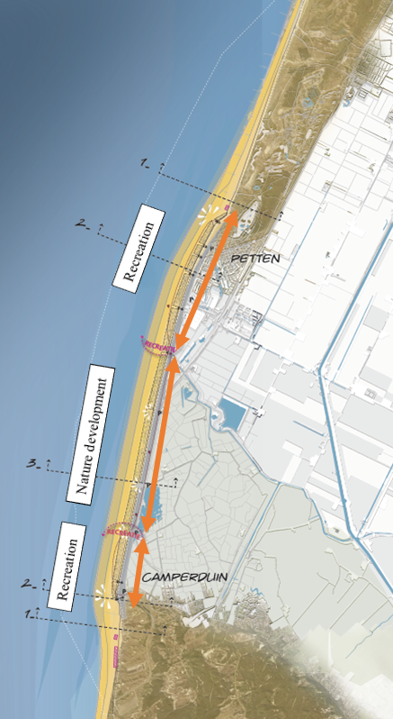
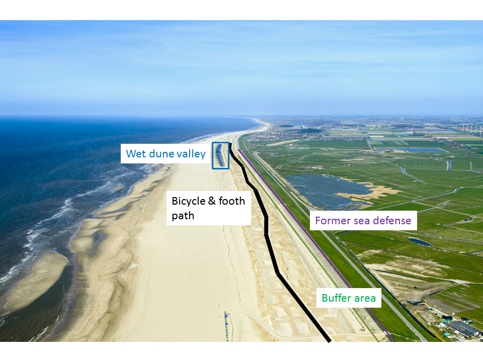
In the project plan for the new sea defence a spatial zonation is applied (Figure 1). In the middle section nature development prevails with a wet dune valley and a large habitat for birds and plants. At both sides there is space for recreation and tourism. These areas are situated close to the existing villages of Petten and Camperduin.
Design
The design of the Hondsbossche dunes had several project requirements. First of all, the safety requirements had to be met within the project boundaries. The coastal defense had to be able to withstand 1/10.000 year stormconditions. Secondly, the dunes had to be designed for 50 years taking into account sea level rise. Furthermore, the dune top should not exceed 12 m + NAP and the coastline must be smooth. An important part of the design was the incorporation of environmental quality (recreation, infrastructure and nature) and taking into account uncertainties (see the tool: Visualising and managing uncertainties). In the end, a design was made based on the minimum profile needed to meet safety requirements, and a buffer to compensate for losses during the maintenance period. It makes optimal use of available sand using a feeder beach, providing maximal technical and spatial quality and minimal hindrance.

Natural quality and recreation
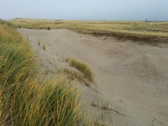
The design aims for four habitat types of Natura2000 namely: foreshore habitat (permanently submerged sandbanks, H1110), embryonic dunes (H2110), dunes with sea buckthorn (Hippophaë rhamnoides, H2160) and a dune slack (lowering between the dunes where the water table lies close to the surface, H2190). Dune slacks were included in the design to improve natural quality of the dune area. The design also provided recreational opportunities for citizens and visitors, like bicycle- and footpaths and a horse track.

In English: Grey seal (grijze zeehond), black seaduck (zwarte zee-eend), sword sheath (zwaardschede), big tern (grote stern), dwarf tern (dwergstern), ringed plover (bontbekplevier), natterjack toad (rugstreeppad), beach plover (strandplevier), dune pearl butterfly (duinparelmoervlinder), sand lizard (zandhagedis), nightingale (nachtegaal)
white dunes (witte duinen): sand oats (zandhaver), marram grass (helm), sea milk thistle (zeemelkdistel), blue sea thistle (blauwe zeedistel), sea wind (zeewinde), sea wolf’s milk (zeewolfsmelk),
moist dune valley (vochtige duinvallei): green tuber orchid (groen knolorchis), button band (knopbies), kneeling pangassia (knielparnassia), yellow heart (geelhartje), duinrus (duinrus)
dune strudel (duinstruweel): sea buckthorn (duindoorn), wild privet (wilde liguster), single hawthorn (eenstijlige meidoorn), barberry (zuurbes)
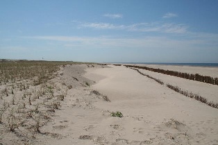
The construction contains measures to capture the sand and reduce sand transport. Apart from planting marram grass, these measures included willow screens. Artificial Relief Features (ARF) were introduced to increase the natural dynamics in the area.
Stakeholder involvement
In the initiation phase, the concerns and preferences of the local citizens were collected via official letters asking for their reaction to the plan. It turned out that for the local citizens, a main concern was that the new dune area would lead to sand transport into the hinterland of the dike (into ‘their backyard’). In a response to the local people’s concerns, the design was adapted to minimise sand transport behind the dike. This was done by creating a ‘buffer area’ between the dunes and the dike and by putting straw bales into this buffer area to capture the sand. Furthermore, the marram grass and dune lake would trap most of the sand within the dune area.