Construction
From August to September 2008 130,000 m³ of sand was deposited on the Galgeplaat in a low circular mound, creating a kind of sand reservoir.
First, a protective ring of sand was built, approximately 1 m high with a diameter of 450 m. The ring was made by bulldozers with sediment taken from the flat itself. At the south east side an opening was created for discharging excess water during the nourishment operation. At the inner side of the opening a settling-basin was excavated, in order to reduce the content of suspended matter in the effluent. The opening was oriented towards the nearby channel (Brabantsche Vaarwater).
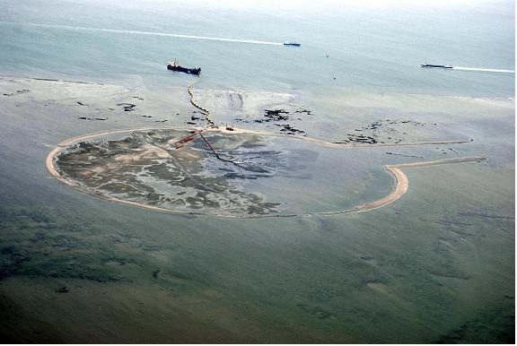
This ring was filled with sand during the flood phase of the tidal cycle and spread by bulldozers during the ebb phase. The time phasing for the nourishment activities was based on the water level reaching the top of the ring wall. This allowed for a construction process with a controlled dredging-induced turbidity in the surroundings.
During and directly after the nourishment the concentration of suspended matter in the water around the tidal flat was monitored continuously at five locations, enabling an intervention if needed. The maximum sediment concentration in the water column near the commercial mussel beds was set at 50 NTU over and above the background sediment concentration in the water column. This maximum was exceeded twice during the nourishment activities. Both times the nourishment activities were allowed to proceed after an analysis of the situation by Rijkswaterstaat.
The sand for the nourishment, dredged from two adjacent channels, was slightly coarser than that on the tidal flat. This resulted in a small increase of the median grain size at the nourished location, but not in a change of the relative grain size distribution (Holzhauer and van der Werf et al., 2010).
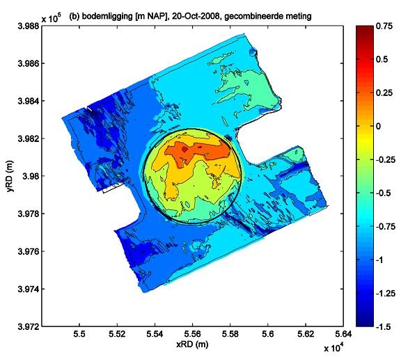
The surface of the nourishment was not horizontal, but mildly sloping, with a maximum at NAP + 0.4 m and descending to NAP – 0.6 m in the south. This was an unintended consequence of a lack of sediment at the end of the construction phase.