How to Use
This concept is designed for muddy coasts and estuaries. Boundary conditions to enable this concept are as follows. Firstly, there should be a surplus of sediment in one location (e.g. a port) and a deficit of sediment at a proposed other location. In case of the latter, for example, insufficient sediment for a mudflat and/or salt marsh to grow with sea level rise. Secondly, it must be possible to capture the disposed sediment at the selected location on the long term. If the sediment remains in the water column, it can increase turbidity and decrease water quality. If the sediment is transported back to the port, it needs to be dredged out again. Lastly, the system should not be too dynamic. Strong coastal dynamics can lead to erosive processes, which counteract the goal of this concept. If this is a potential concern, additional concepts may be required, to prevent resuspension and loss of sediment. Moreover, when combined with other concepts, this concept may contribute to coastal defense on the long term.
The steps that outline the approach for this concept are given below. Consider combining this approach with the development or restoration of salt marshes, see Restoring tidal ecology or the facilitation of other ecosystem engineers.

Step 1: What is the sediment source and where can it be found?
What the first step is that needs to be taken, depends on the specific case in which you apply the concept. Roughly, there are two possible cases: (1) you have a location with an excess of sediment and want to use the sediment in a beneficial way, or (2) you have a shortage of sediment in a certain location along the coast, but still need to find a source of sediment.
In the first instance, you already have a sediment source. In that case, find out whether the sediment can be obtained (e.g. dredged) and what the origin of this sediment source is. In the second case, you need to look for a source of sediment. Lakes and ports are often sheltered areas where sediment settles, but there are also Building with Nature strategies that focus on sedimentation of fines in turbid waters. In that case, it will take some time before you can obtain the required sediment.
The origin of the sediment sets the properties of the fine material to be used. Moreover, the amount and deposition rate are also important to estimate the way it will be transported and how fast it settles. Special attention should be given to the potential presence of contaminants in the sediment source. Because of the large surface area and chemical properties of clay particles, contaminants are often adsorbed to clay particles and may be transported. Therefore, pollutants are generally found in cohesive fine sediment deposits. Recently it was found that dredged fines in the port of Harlingen (the Netherlands) satisfies the required quality for the most part (see documentation Mudmotor Koehoal). In the mouth of the port, the quality was generally good, while in the corners of the port, most away from the mouth, contaminated sediments were found that could not be used for further application or disposal.
Step 2: Understanding the hydrodynamic conditions
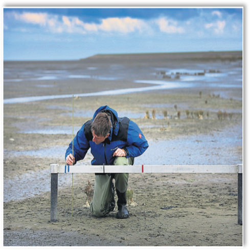
Key to this concept is to make sure the disposed sediment ends up in the right place. This requires material to be disposed at the right time and in the right place, depending on the required transport direction. To be able to do so, you need to understand the system before planning any measures. Understanding the systems holds predominantly for the tidal flow conditions, natural sedimentation processes, nature development and natural variability as outlined above. This means that you need to assess key parameters that describe hydrodynamic conditions, sediment transport, morphological conditions and the local ecology. System analysis can be based on data, measurements or tracer experiments when available. If needed, a hydrodynamic or morphological model can be used to reproduce the behaviour of the system. With a model, you can assess whether the material you dispose gets trapped at the location you desire.
Step 3: Selecting the appropriate disposal site, method and timing
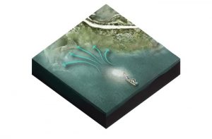
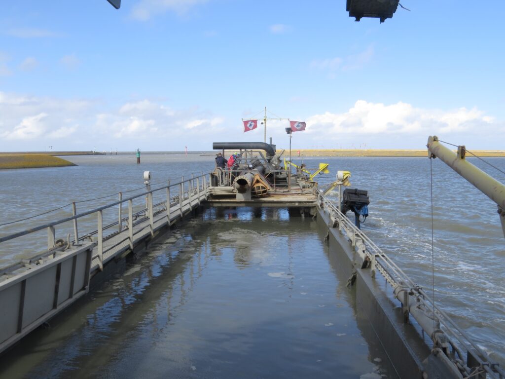
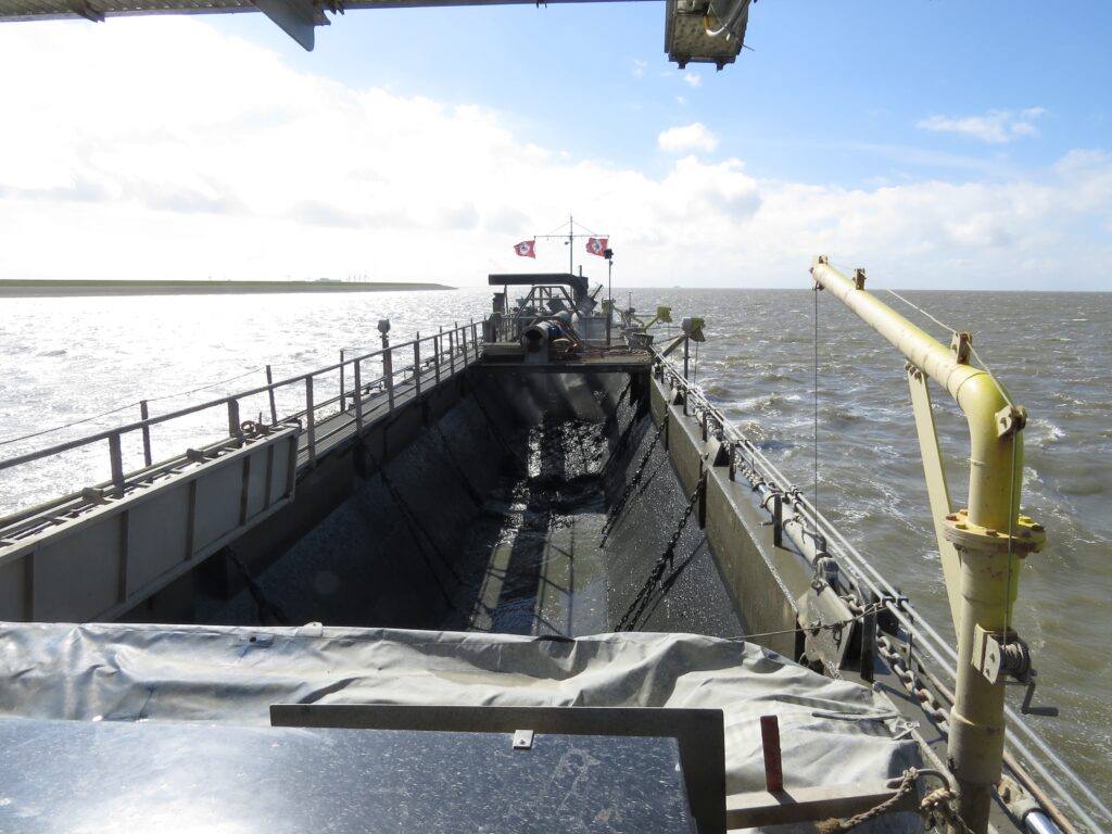
But where should the dredged sediment be disposed? This entire strategy is focussed around strategically disposing the mud. Usually, the dredged sludge is thought to be useless and it is disposed at designated locations in the open sea. However, by disposing the mud in the right location along the coast, it can in fact provide benefits for the coast and save costs. In the Ecoshape Mud Motor pilot we showed that the net transport direction is dependent on the cross-shore distance of the disposal site in the tidal channel relative to its banks. A disposal site at the ‘left’ bank of the flood-dominated channel resulted in a leftward transport of fines while a disposal at the ‘right’ bank gave a rightward transport.
Based on sailing distance, dredge cycle times, the draught of used vessels, tidal water level predictions and daylight windows an assessment of disposal sites and timing can be made. In the Ecoshape Mud Motor pilot the disposal was planned only during flood tides, i.e. when flow is directed towards the salt marsh target area. Three different disposal locations were defined for three phases of the tidal cycle, i.e. flood flow at low water level, at medium water level and at high water level, where the latter was closest by the target area. An analysis of the co-occurrence of flood flows and daylight hours revealed what time windows were available for disposal.
Disposed mud can remaining in suspension for a long time and fine sediment has direct implications on turbidity and underwater light climate. This is important to acknowledge as turbidity and light climate affect primary production. The dredging and disposal strategy should minimise turbidity as much as possible. Therefore, linking the disposal with the right tidal conditions should facilitate rapid transport and sedimentation in the right location. Consider modelling the possible scenarios, e.g. with a 3D hydrodynamic and suspended sediment transport model including a bed module.
Modelling can help in assessing the uncertainties involved and provide input for the environmental impact assessment that probably is required to obtain a permit. How much sediment reaches the allocated areas? When is the sedimentation speed to high for ecosystems to adapt? How do uncertainties in the the strategic placement affect any sensitive habitats?
Step 4: Monitoring and evaluation
After selecting an appropriate disposal strategy, it is important to be able to evaluate the effects. After all, the strategically disposing mud is highly adaptable and is potentially repeated. Using a monitoring program and evaluating the results can aid in adapting the strategy to obtain optimal results. To develop a monitoring program, the following questions should be answered: What are the goals of strategically disposing mud in this specific case? How can those goals be measured in the field? What is the natural evolution of the targeted area without any interventions? Monitoring should consist of both a period before the intervention, the period during which the disposal is carried out and the time the system needs to respond to such a measure. Monitoring will aid in adapting the approach in the future.