Practical Applications
The Interactive Design Tool for the Holland Coast has already been used in workshops, where various stakeholders made plans for the future of the Dutch coast. It is an effective tool to visualise the impact of management measures (nourishments and revetments) in both time and space. This is of great value because individual processes act as different temporal and spatial scales, and respond differently to the measures.
- Atelier Kustkwaliteit (AKK)
- Ecologically Smart Nourishments
- Other applications
1. Atelier Kustkwaliteit (AKK)
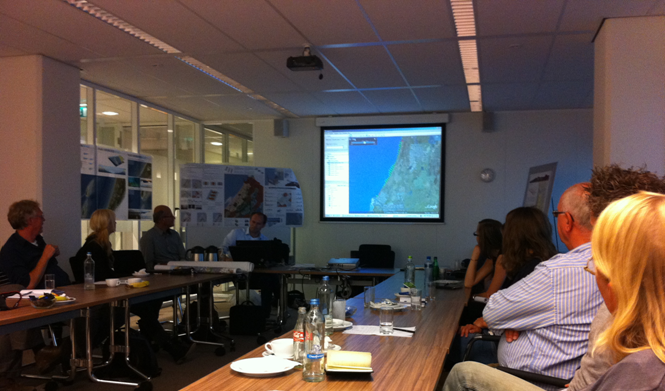
The Interactive Design Tool for the Holland Coast was successfully applied in several stakeholder workshops of Atelier Kustkwaliteit between September 2011 and June 2012 (see photo below). In these workshops stakeholders from various backgrounds (i.e. policy makers, ecologists, landscape architects, beach club owners, golf club board members, drinking water companies) got together to develop alternative visions/designs for (parts of) the Holland Coast in 2100. The designs that were developed in split sessions in the morning were evaluated with the tool and discussed in a plenary afternoon session. The contributions of the tool during the sessions on the “Stille Kustlandschappen” have been incorporated in a workbook. The results of an inquiry held during a workshop in June 2012 indicate that most respondents believe the tool provided a useful contribution. The respondents mentioned the following strengths: fast, insightful, enabling to test ideas on the fly and providing insight into the interaction between different coastal interventions. Weak points mentioned were the lack of detail (simplifications) and the absence of information on the uncertainties in the visualizations. Most respondents indicated they were happy with the choice of Google Earth for the visualizations.
Lessons learned in AKK workshops
- Google Earth visualizations help to show that coastline evolution is a dynamic process and coastal interventions affect coastline evolution in both space and time. For most participants this was an eye-opener, as they considered the coast as a static feature where interventions only have local, short-term impacts.
- The quick feedback on the participant’s choices resulted in a learning effect. The lessons learned from previous designs were incorporated in new ones.
- Some of the workshop participants tended to interpret the Google Earth visualizations of the model results as the truth. Participants even tried to measure coastal erosion and accretion after a 100 years simulation in meters precision (which is not the level of detail that the model is able to predict). This stresses the need for an expert moderator putting the model results into perspective.
- Stakeholder feedback is essential when developing a functional design tool.
- Building the tool in Matlab allowed for rapid prototyping: development of extensions and adjustments of the tool’s functionality. Suggestions/demands from previous design sessions could be incorporated in the next session.
2. Ecologically Smart Nourishments
Within the BwN project on Ecologically Smart Nourishments, the Tool has been applied on five coastal defence scenarios to test their impact on benthos, nursery habitat for juvenile fish, and dunes:
- Autonomous
Autonomous development without any measures. - Minimal continuous preservation
Specific settlements and other risk areas are protected against erosion by continuous beach and surf zone nourishments of 5.0 million m3 per year, whereas other locations do not receive nourishments. - Minimal five-yearly preservation
Minimal protection of the entire coast at coastal settlements with shoreface nourishments of 12.5 million m3 every 5 years. - Seaward
Extending the coastline gradually seawards with the help of mega-nourishments of 20 million m3 each, that are applied every ten years at five locations along the coast (Vlugtenburg, Katwijk, Zandvoort, Egmond and at the Hondsbossche zeewering). - Revetments
Revetments protecting the coastal settlements (no additional nourishments)
The results of the scenario computations with the IDTHC were used to derive guidelines for ecologically optimised nourishments. These guidelines consist of recommendations on the design of sand nourishments, in terms of frequency, location and size. The focus of such strategies in the context of this study was to improve the nursery function of the Dutch coast for commercial and non-commercial fish species, while minimising impacts on benthic populations, and enhancing dune quality.
From the benthos and dune modules it followed that large nourishments at long time-intervals show the best potential for benthos and dunes. They allow benthic populations to recover fully from the impact and lead to, at least temporarily, new dune formation. The dynamics in growth and erosion of the dunes in such situation give rise to repeated pioneer habitats, which is considered beneficial for the currently rather static dune area of the Holland coast. However, the potential for juvenile fish nursery areas depends on foreshore width, and thus on overall nourished volume rather than nourishment frequency, given the current fixed profile. Building the coast seaward, thereby steepening the profile, has detrimental effects on the size of the nursery habitat for juvenile fish.
The results further show that ‘continuous’ nourishments prevent full recovery of the benthic population, even if the reduction in carrying capacity per nourishment event may be small. Only opportunistic species such as worms are able to fully recover to their carrying capacity. It is plausible that due to frequent nourishment more opportunistic species will dominate. These potentially provide good prey and feeding conditions for juvenile fish. The autonomous scenario, without nourishments, shows considerable erosion along the coast. Consequently, the foreshore area increases slightly, which results in a larger nursery area for juvenile fish.
Sand nourishments reduce the carrying capacity locally and temporarily. Revetments, however, are of a more permanent nature and are assumed to result in a complete local loss of habitat for bottom dwelling organisms needing a sandy environment. Despite this loss, revetments do provide habitat for other species and communities that prefer hard substrate (e.g. polyps) or use crevices for shelter (e.g. crabs, fish). Given the assumptions in this model the net effect of a revetment is considered zero for benthos and fish. But because they stabilise the dunes completely, revetments score less on that aspect.
The present version of the tool is a first, necessarily using many simplifications. The results give a first estimate that is sufficiently reliable for practical use, but they don’t give an in-depth analysis. The true gain of this exercise is that an easy-to-use prediction tool is conceptualised, developed and applied in workshops with stakeholders. By presenting various aspects of the impact of coastal measures together through space and time, even in a yet simple form, users obtain a better understanding of the consequences of coastal strategies. Finally, by applying the tool, it becomes clear which next steps are needed to strengthen both the underlying knowledge and the model definitions.
The complete report is available as Developing an Interactive Tool for evaluating sand nourishment strategies along the Holland Coast in perspective of benthos, fish nursery and dune quality. Further background on the dune module can be found in Long-term coastal dune development in the Interactive Design Tool.
3. Other applications
The tool in its current form may facilitate the communication between experts, actors and stakeholders in practically any type of initial assessment of coastal interventions on the Holland Coast and similar types of sandy dune coasts. For example, the tool may be of use to the initial coastal strategy development in the Dutch Delta Program for the Coast. As pointed out in General Tool Description, the structure of the Interactive Design Tool allows for incorporating other types of models, which makes it potentially useful for any type of MapTable application. Potentially, tools can be developed for any location in the world, any aspect (or combination of aspects) and any phase of the design process (i.e. level of detail). With adapted parameterisations, the current version of the tool can also be used for other locations.